Round Two · Launches June 29, 2026
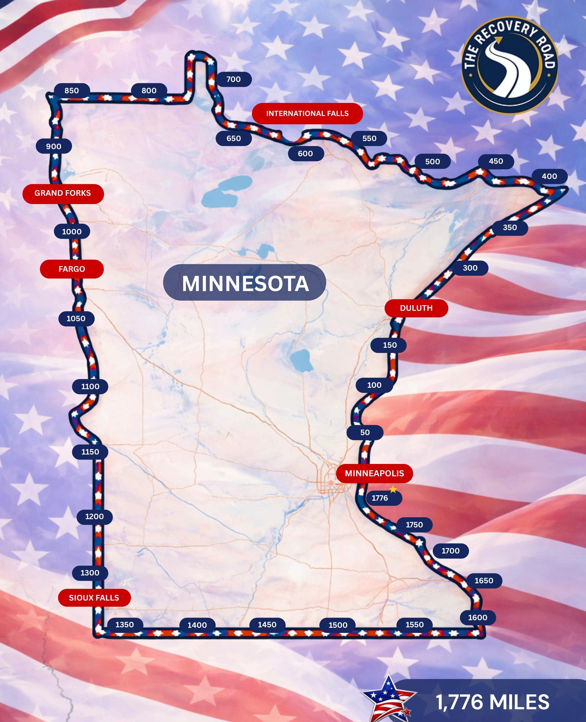
1,776 miles around Minnesota. Every corner.
This round, we're walking the perimeter of Minnesota with a focused lens on youth mental health. Because every kid in this state should be able to get care. And right now, too many can't.
1,776
Miles
30+
Border counties
6.29.26
Launch
What we're doing
The Journey
Walk
1,776 miles around the perimeter of Minnesota.
Collect
Standardized data from all 87 counties. On the record. The quantitative spine.
Capture
Stories, faces, testimony. Documentary-quality content from day one.
Raise
Funds that flow directly to what the walk finds.
Build
A gap report, a policy brief, and a case file delivered to St. Paul and DC.
Create
Community where it didn't exist. A road people keep walking long after we finish.
The route · Day by day
Jason's daily plan
92 walking days · 1769.5 planned miles tracked so far. Distances marked TBD will firm up as we scout the final stretch.
- Jun 29StillwaterTaylors Falls29.4
- Jun 30Taylors FallsRush City, MN35
- Jul 1Rush City, MNHinckley, MN24.1
- Jul 2Hinckley, MNBruno, MN26.6
- Jul 3Bruno, MNHolyoke, MN19.4
- Jul 4Holyoke, MNOliver, WI21
- Jul 5Oliver, WIDuluth, MN14
- Jul 6Duluth, MNKnife River, MN19.6
- Jul 7Knife River, MNGooseberry Falls State Park7.9
- Jul 8Gooseberry Falls State ParkBeaver Bay, MN24.8